
Hello guys, sorry for my long absence here on the blog – I’ve had a migraine the size of Texas that makes looking at the computer screen a very big challenge. It’s still there, but lighter, so here’s hoping we’re on the upswing! Anyways, homeschooling (and teaching) rarely stops for a headache, so I wanted to share with you a project my boys did this week.

Instead of completing separate Science and Social Studies units, my kiddos are doing year long Country Study Projects. Each month, we spend three weeks researching a specific topic in regards to our country – through books, encyclopedias, videos and field trips – and then on week four, the kids take all of what they have “learned” and put it into action with a hands-on or technology based project. I give the kids some basic expectations for their project, but they have a lot of freedom with how they want to create and deliver project.
For the last three weeks, we have been looking at the geography and climate of our countries (Russia for my 2nd grader and China for my 5th grader), so this week they were tasked with creating a map.
My younger son is much more of a kinesthetic learner, so he chose to create a salt map, giving him a chance to build the Ural Mountains and Bakail Lake with his hands and paint not only the landforms, but the bordering countries and the Arctic Ocean. We used a recipe I got from another blogger I love – Becky from Kid World Citizen and he had so much fun that he kept telling me “This isn’t work mom, it’s easy!” Here are a few pictures of the process:
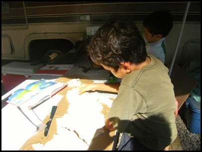 First, he spread the clay out on the cardboard with the outline his daddy drew for him.
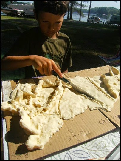 Then, he added in all of the landforms. This took a few trips back to the map to determine where exactly those rivers and mountains were supposed to be.
 Finally he determined colors for his landforms and countries and had a blast painting his map.
 And here is the final product.
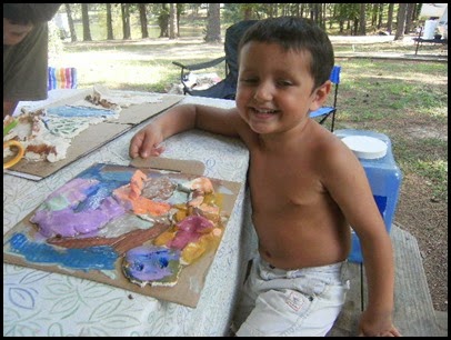
Since we were playing with clay, the little one (3 years old) decided he needed to get in on the action too, so he created the first letter of his name – S.
My oldest son is a technology guy and so he took a completely different take on this project. Using Power Point, he created a layered map, and then recorded himself explaining the map using Camtasia Studio – the same program that I use for my Math Mini Lesson Videos. Besides showing him how to draw on the map, he created this project completely independently – which was great for a mom with a headache!
Although both of the maps made by the boys came out quite differently, what I noticed was that during the process of making the maps, the kids would say things like “I know the mountains are in the East, but where?” and go back to the map to check again. They were clarifying and building on to their own knowledge by building this project. This will keep it in their memory so much longer than if they had memorized the information to study for a test. Hope your week of teaching and learning was as fabulous as ours was!

Instead of completing separate Science and Social Studies units, my kiddos are doing year long Country Study Projects. Each month, we spend three weeks researching a specific topic in regards to our country – through books, encyclopedias, videos and field trips – and then on week four, the kids take all of what they have “learned” and put it into action with a hands-on or technology based project. I give the kids some basic expectations for their project, but they have a lot of freedom with how they want to create and deliver project.
For the last three weeks, we have been looking at the geography and climate of our countries (Russia for my 2nd grader and China for my 5th grader), so this week they were tasked with creating a map.
My younger son is much more of a kinesthetic learner, so he chose to create a salt map, giving him a chance to build the Ural Mountains and Bakail Lake with his hands and paint not only the landforms, but the bordering countries and the Arctic Ocean. We used a recipe I got from another blogger I love – Becky from Kid World Citizen and he had so much fun that he kept telling me “This isn’t work mom, it’s easy!” Here are a few pictures of the process:
 First, he spread the clay out on the cardboard with the outline his daddy drew for him.
 Then, he added in all of the landforms. This took a few trips back to the map to determine where exactly those rivers and mountains were supposed to be.
 Finally he determined colors for his landforms and countries and had a blast painting his map.
 And here is the final product.
Since we were playing with clay, the little one (3 years old) decided he needed to get in on the action too, so he created the first letter of his name – S.
My oldest son is a technology guy and so he took a completely different take on this project. Using Power Point, he created a layered map, and then recorded himself explaining the map using Camtasia Studio – the same program that I use for my Math Mini Lesson Videos. Besides showing him how to draw on the map, he created this project completely independently – which was great for a mom with a headache!
Although both of the maps made by the boys came out quite differently, what I noticed was that during the process of making the maps, the kids would say things like “I know the mountains are in the East, but where?” and go back to the map to check again. They were clarifying and building on to their own knowledge by building this project. This will keep it in their memory so much longer than if they had memorized the information to study for a test. Hope your week of teaching and learning was as fabulous as ours was!


