Showing posts with label Countries. Show all posts

Saturday, September 24, 2016

Student Created Map Project Presentations

For the past two years as a homeschool parent, I have done a country study with my children. We studied China, Russia, the United Kingdom and Germany. (You can read about what we did in this old blog post.) This year I am back in a classroom, but I was determined to complete country study projects with my students. I wasn't sure how I would balance studying 34 different countries, but my co-teacher and I sat down, looked at it and found a way to make it work. We teach our core subjects, math, reading, writing and grammar Monday through Thursday. Then on Friday, we apply all of what we have learned about reading for information and written communication, add in Social Studies and Science and do research for our country study.

Country study project - a year long project to teach 3rd graders about the countries of the world. Our first unit is geography and climate and our first project is to create a map. Brought to you by Raki's Rad Resources.

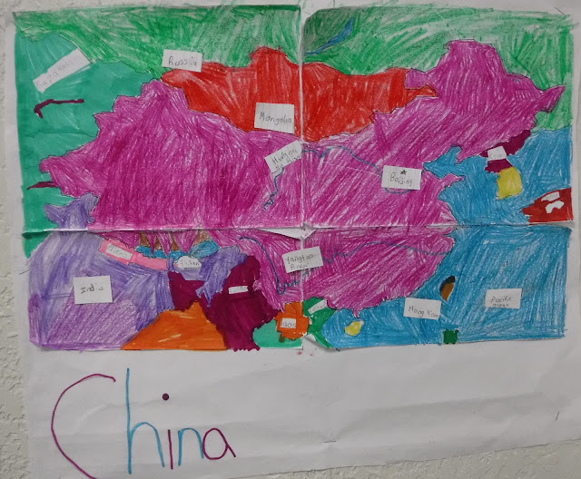
The students are studying a wide range of countries, from Japan to Greece to Brazil to Tonga. For this first month, we used atlases, trade books and internet research to learn about the cities, the bordering countries, the landforms and the average temperature of our countries. Then, the students created maps of their countries.

This Friday the students "presented" their maps to their classmates and parents using a museum technique. The students whose countries were in a specific continent stood at their maps while the others rotated around. Students who were at their maps told the visitors about their country and their map. Visiting students asked questions. Then after ten minutes, we switched to a new continent and there were new presenter. The students were engaged all day and everyone learned a lot! Here are a few of their maps:

Country study project - a year long project to teach 3rd graders about the countries of the world. Our first unit is geography and climate and our first project is to create a map. Brought to you by Raki's Rad Resources.

Country study project - a year long project to teach 3rd graders about the countries of the world. Our first unit is geography and climate and our first project is to create a map. Brought to you by Raki's Rad Resources.

Country study project - a year long project to teach 3rd graders about the countries of the world. Our first unit is geography and climate and our first project is to create a map. Brought to you by Raki's Rad Resources.


Country study project - a year long project to teach 3rd graders about the countries of the world. Our first unit is geography and climate and our first project is to create a map. Brought to you by Raki's Rad Resources.

Country study project - a year long project to teach 3rd graders about the countries of the world. Our first unit is geography and climate and our first project is to create a map. Brought to you by Raki's Rad Resources.

The majority of my students have never traveled out of the United States, or learned about other countries, so this project is a perfect way to expand their understanding of the world. In addition to guiding my students through research, I have been using our blog as a way to reach out to people who live or have lived in various countries.  I have asked friends that live or have lived outside of the USA to stop by our 3rd grade blog and leave us a comment about what it is like to live in a country other than the USA. If you know anyone that would be interested in leaving us a comment, please feel free to stop by our 3rd grade blog.

Next Friday we will begin researching the plants, animals and habitats of our countries. We will be creating food webs for our projects. I can't wait to see what the students learn.

If you'd like to do a country study project with your class, you can find my entire Year Long Country Study Project available for purchase at my Teachers Pay Teachers store.


Saturday, May 2, 2015

Social Media Timelines

make timelines more fun by allowing students to create a series of social media posts. Ideas and resources from Raki's Rad Resources. 

Last month my kids were tasked with the project of creating a timeline about the country they have been studying this year. This was their final project for the history section of their Year Long Country Study Project. I often feel that timelines can be kind of a boring project. However, putting those events they have learned about into some sort of order helps kids to process the information better.

My oldest son read the project sheet and actually got excited. He didn’t feel that this project was boring at all. “Hey mom, can I make this like those fake Facebook histories?” he asked me. (If you don’t know what I’m talking about – check out the Facebook History of the World, but be warned it is a bit PG13 for strong language.) Leave it to him to find a creative technology solution for this project! Of course I said yes and he did a good job putting together a Prezi that looks like a series of social media posts or thought bubbles of the people who were actually at the event. Here’s what he came up with:


So if your students are bored with timeline projects, suggest this creative option to them – what would that history look like as a series of tweets or posts – or as an Instagram feed or a Pinterest board? This could also be done with books. Can you summarize this book in a series of tweets from the characters? Technology is a huge part of our kids’ lives. Rather than run from it, let’s embrace it!

Heidi Raki of Raki's Rad Resources

Saturday, January 31, 2015

Virtual Museum Exhibits

Experiencing and creating virtual museum exhibits with kids.  Ideas from Raki's Rad Resources.

It’s been museum week around here!  On Thursday, we took a field trip to the Colburn Earth Science museum in Asheville, South Carolina.  The kids completed scavenger hunts and explored rocks, minerals, mining, tectonic plates, fossils and weather.

 Experiencing and creating virtual museum exhibits with kids.  Ideas from Raki's Rad Resources.

On Friday, we looked at the virtual museum exhibits of the Smithsonian Natural History museum, which gave us access to the amazing exhibits and information of this museum. 

 Experiencing and creating virtual museum exhibits with kids.  Ideas from Raki's Rad Resources.

Finally, the boys took the information they have been gathering through their Country Study Research Projects to create their own virtual museum exhibits about the fossils you can find in their countries.

My fifth grader, who is studying China, created this prezi:


My second grader, who is studying Russia, created this video using Powtoon:


Year long country study project that allows students to explore all of the main ideas of science - earth science, life science and physical science and social studies - geography, history, culture, government and economics - all while exploring one self chosen country.  Resources from Raki's Rad Resources. In the past when I have studied rocks and minerals with a class, I have had students become experts on a type of rock with my Rock Research Project or a material found on Earth with my Earth’s Materials Online Poster Project.  This is the first time I have focused an entire unit on the geographical history of a specific area.  It was really interesting to see the real life applications that came out in my sons’ explanation write ups including references to climate and the uses of rocks.  The Rocks & Fossils section of our Year Long Country Study Project has beena great unit for bringing together all of the major concepts of Earth Science!

Heidi Raki of Raki's Rad Resources

Sunday, September 21, 2014

Salt Maps Solidify Understanding

Hello guys, sorry for my long absence here on the blog – I’ve had a migraine the size of Texas that makes looking at the computer screen a very big challenge.  It’s still there, but lighter, so here’s hoping we’re on the upswing!  Anyways, homeschooling (and teaching) rarely stops for a headache, so I wanted to share with you a project my boys did this week.
Creating salt maps to help students make sense of geography - great project for elementary and high school alike.  Easy to differentiate - Details at Raki's Rad Resources
Instead of completing separate Science and Social Studies units, my kiddos are doing year long Country Study Projects.  Each month, we spend three weeks researching a specific topic in regards to our country – through books, encyclopedias, videos and field trips – and then on week four, the kids take all of what they have “learned” and put it into action with a hands-on or technology based project.  I give the kids some basic expectations for their project, but they have a lot of freedom with how they want to create and deliver project.
For the last three weeks, we have been looking at the geography and climate of our countries (Russia for my 2nd grader and China for my 5th grader), so this week they were tasked with creating a map. 
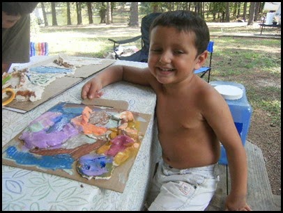
My younger son is much more of a kinesthetic learner, so he chose to create a salt map, giving him a chance to build the Ural Mountains and Bakail Lake with his hands and paint not only the landforms, but the bordering countries and the Arctic Ocean.  We used a recipe I got from another blogger I love – Becky from Kid World Citizen and he had so much fun that he kept telling me “This isn’t work mom, it’s easy!” Here are a few pictures of the process:
Creating salt maps to help students make sense of geography - great project for elementary and high school alike.  Easy to differentiate - Details at Raki's Rad ResourcesFirst, he spread the clay out on the cardboard with the outline his daddy drew for him.
Creating salt maps to help students make sense of geography - great project for elementary and high school alike.  Easy to differentiate - Details at Raki's Rad ResourcesThen, he added in all of the landforms.  This took a few trips back to the map to determine where exactly those rivers and mountains were supposed to be.
Creating salt maps to help students make sense of geography - great project for elementary and high school alike.  Easy to differentiate - Details at Raki's Rad Resources Finally he determined colors for his landforms and countries and had a blast painting his map.
Creating salt maps to help students make sense of geography - great project for elementary and high school alike.  Easy to differentiate - Details at Raki's Rad Resources And here is the final product.
Creating salt maps to help students make sense of geography - great project for elementary and high school alike.  Easy to differentiate - Details at Raki's Rad Resources
Since we were playing with clay, the little one (3 years old) decided he needed to get in on the action too, so he created the first letter of his name – S.


My oldest son is a technology guy and so he took a completely different take on this project.  Using Power Point, he created a layered map, and then recorded himself explaining the map using Camtasia Studio – the same program that I use for my Math Mini Lesson Videos.  Besides showing him how to draw on the map, he created this project completely independently – which was great for a mom with a headache!
Although both of the maps made by the boys came out quite differently, what I noticed was that during the process of making the maps, the kids would say things like “I know the mountains are in the East, but where?” and go back to the map to check again.  They were clarifying and building on to their own knowledge by building this project.  This will keep it in their memory so much longer than if they had memorized the information to study for a test.  Hope your week of teaching and learning was as fabulous as ours was!
Heidi Raki of Raki's Rad Resources

Thursday, January 10, 2013

Lessons Learned in Ireland

My family and I have been back from our wonderful winter vacation in Ireland for almost a week now and we’re busily trying to get back into “real life”.  My husband and I rented a house in Ireland.  We took our three sons (age 8, 5 and 1 1/2) and my grandmother traveled from the US to meet us there.  It was a wonderful time and a great way to expose to yet Exploring Ireland with my family over winter breakanother different culture and different ways of doing things.  It was also a way to experience the “Christmas feeling” that we miss by living in Morocco, a country where most people do not celebrate Christmas.  Here are some of the things my family learned/experienced during our trip:

1.) British/Irish English – Many of our fellow expats here in Morocco are from England or Ireland, so we are used to this dialect, but being surrounded by thiExploring Ireland with my family over winter breaks daily for 2 weeks gave me a better understanding of where the differences between British English and American English lie.  It was fun to see signs that said “Take Away” instead of “Takeout” and “To Let” instead of “For Rent”, and to hear 8:30 described as “half 8”.  As I am teaching a UK curriculum this year, this reminder of the vocabulary differences was very important for me and I am trying to be sure to include both sets of vocabulary when I am working with my students.

2.)  Short Days – To truly understand the concept of Exploring Ireland with my family over winter breakhow short a day is in the northern climates, you must truly be there.  Since we were in Ireland during the winter, the sun didn’t come up until 9:30 a.m. and it was completely down by 4:45 p.m.  The lack of sunlight has an effect on you, but I would love to go back in the summer when I was told that the sun comes up by 5 a.m. and doesn’t go down until almost 11 p.m.

Exploring Ireland with my family over winter break3.)  Driving on the Left Side of the Road – Not only the driving, but also realizing that the side we drive on is also the side we walk on and the side we of the stairs we go up.  I often found myself walking on the wrong side, especially when going up the stairs.   

4.)  History is amazingly interesting!  I love exploring old buildings and cemeteries and Ireland was great for this. We explored castles, churches, cemeteries and even New Grange, a tomb that older than the pyramids!  Here are some pictures of what we saw:

Exploring Ireland with my family over winter break     Exploring Ireland with my family over winter break

Exploring Ireland with my family over winter break     Exploring Ireland with my family over winter break

Exploring Ireland with my family over winter break            Exploring Ireland with my family over winter break

The money I earned from selling teaching resources on Teachers Pay Teachers helped us to afford this amazing trip.  If you are interested in creating a Teachers Pay Teachers store for yourself – click HERE for more details.


Heidi Raki of Raki's Rad Resources

Thursday, July 12, 2012

Neighbourhood Walk Around the World

neighbourhood-walk-badge

Jo Ebisjum of JoJebi Designs is doing a “neighbourhood walk around the world”.  When I first heard about this, I thought – “Wow, what a great way to help kids kids understand that all areas are alike and different at the same time.  Many kids do not get the opportunity to travel the world, but with a project like this, they can virtually travel all around the world. 

Journey to Morocco - A Walk Around the NeighboorhoodYou can check out my neighborhood here in Casablanca, Morocco at my personal blog – Journey to Morocco.  And if you head over to JoJebi Designs, you can find links to all the other neighborhoods around the world, including places like Japan, Greece and Australia. 

How can you use this project with your kids?

Heidi Raki of Raki's Rad Resources and Journey to Morocco